Test

Certified B Corporation — Adaptive Retrofit — Humanising Infrastructure — Making better places — Architecture — Public Realm — Spatial Strategy — Creative Reuse — Urban Transformation — Decarbonisation —

Paddington Public Realm Strategy— London

Client(s)

Westminster City Council

Collaborator(s)

JCLA / Studio Dekka / NRP / Daisy Froud

The Paddington Places strategy seeks to transform North Paddington’s fragmented neighbourhoods into a vibrant, healthy, and inclusive area by rebalancing the environment to enable legible and safe pedestrian and cycle movement, and to create great public spaces.

The Paddington Places strategy includes a programme of projects that will be delivered across a range of timescales. The development programme includes short term projects, such as small public realm improvements, to be delivered over the next few years; medium term projects such as new public spaces and street renovations over the next 10 years; and long term projects such as new developments or major changes to highway layouts that will likely be delivered after 2030.

Over the last 250 years, Paddington and the communities that live and work there have been increasingly separated by large strips of infrastructure: the railway, the canal, and most visibly the Westway. There are only a few safe places to cross this infrastructure, meaning that it has become increasingly difficult to walk and cycle to nearby neighbourhoods, and therefore communities are potentially missing out on great opportunities and places that are nearby. This is the issue that this project aims to address.

The design team is led by 5th Studio and includes, Jonathan Cook Landscape Architects (JCLA), Studio Dekka, and Daisy Froud. Additionally, the design team are collaborating with Norman Rouke Pryme (NRP) who are undertaking a wider highways strategy for the area. 5th Studio, are leading the Paddington Places engagement programme, with professional guidance from Daisy Froud.
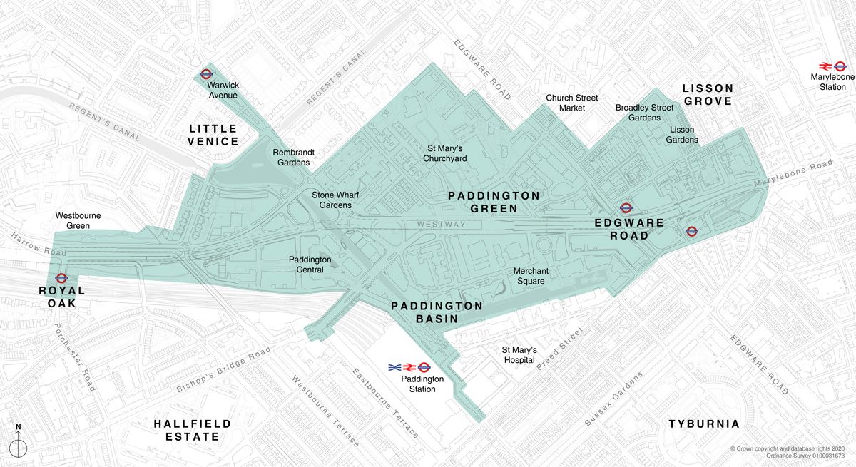
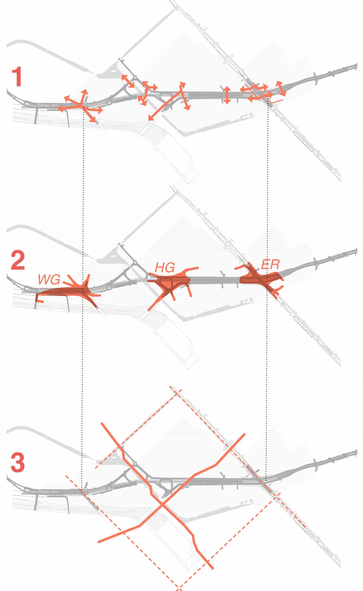
The extents of the study
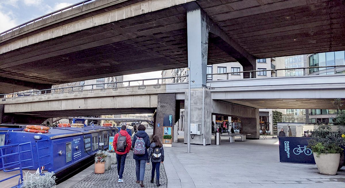
The Westway causes significant impacts across the study area

The Challenge

The north Paddington area has been separated by large pieces of infrastructure over time including the railway, the canal, and the Westway. There are only a few safe places to cross these, meaning that it is difficult to walk and cycle to nearby neighbourhoods, and communities are missing out on opportunities to access places that are nearby. The area is made up of places with distinct characters but sometimes feels fragmented and incoherent.

There is a significant amount of anticipated development in the area. A strategic approach to public realm improvements could help to create coherence across old and new places and build on some of the improvements already carried out in the area.

The project team are developing concept ideas for projects whilst testing and refining a strategic vision for the area. The proposals will provide a holistic approach and guidance for future growth and development in the North Paddington area.

The Paddington Places project aims to:

1. Create better crossings for pedestrians and cyclists across the railway, the canal and the Westway

2. Improve and activate under-used public spaces to provide local amenity – with works to adjust roads to create more high-quality space for local people

3. Create new and better routes for pedestrians and cyclists that tie into existing and proposed walking and cycling networks across the wider area and between key neighbourhoods and destinations

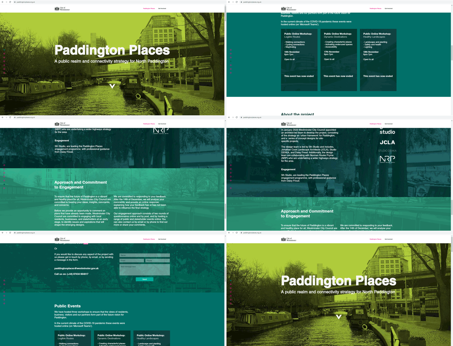
Our team developed a bespoke consultation webpage, supporting engagement with the local community during the initial COVID-19 lockdown

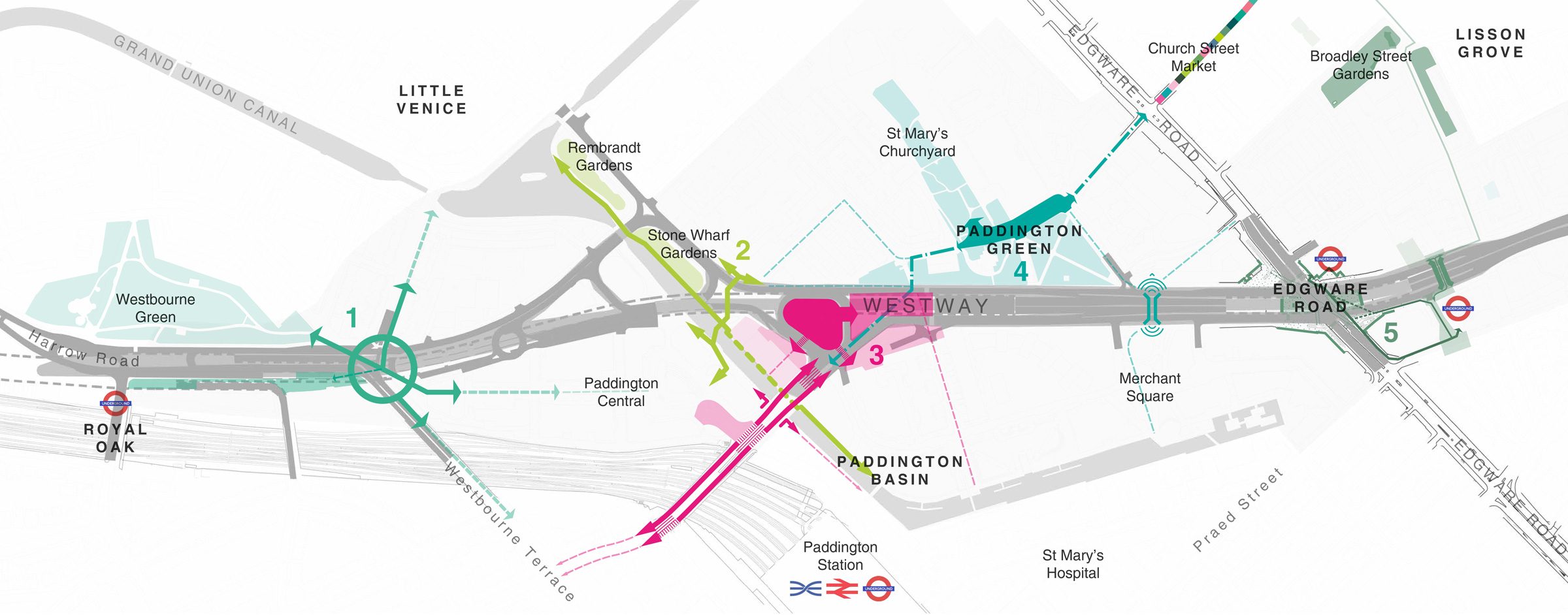
1. Westbourne ‘Gateway’

The junction of Westbourne Terrace and Harrow Road was reshaped by the arrival of the Westway in the 1960s, prioritising vehicle movement over pedestrians and cyclists. This has created problems in this area, including disconnected neighbourhoods and places bounded by infrastructure. The junction has few crossing locations and a poor-quality environment for pedestrians and cyclists.

2. The Canalside

The canal is an asset to the area as an ecological corridor, as well as for leisure and providing open space. Although mostly accessible, some areas are not and feel disconnected from the locale. Both Paddington Central and Merchant Square have introduced significant public realm improvements along the canalside. The towpath alongside Rembrandt Gardens to Travis Perkins is underused and suffers from poor accessibility and connectivity to the rest of the area. Poor quality and inconsistent lighting along this route contrasts with the bright lighting on the other side of the canal at Paddington Central.

3. Harrow Road Gyratory ‘Old Dudley Grove’

The gyratory is dominated by vehicle traffic and is currently a hostile environment for both pedestrians and cyclists. The current layout creates barriers to movement, in particular north-south connectivity. The existing crossing at Hermitage Street is important and well used, but struggles with visibility issues and to capitalise on wider connections to local destinations.

The enclosed space created by the Westway’s structure suffers from poor visual connections to other areas such as the canal. Poor legibility is compounded by insufficient wayfinding and poor quality lighting.

4. PADDINGTON GREEN AND ST MARY’S CHURCHYARD

​Paddington Green, St Mary’s Church and the Churchyard are an important heritage asset. They are established spaces, but suffer from being disconnected with the surrounding area. The Westway has reshaped their historic footprint and acts as a barrier to north-south connectivity.

Working with St Mary’s Church would be vital in understanding how these landscapes could be brought back into more active use and better link to other local places.

5. MARYLEBONE FLYOVER – EDGWARE ROAD AND CABBELL STREET

The completed TfL Safer Junction project and soon to be delivered SuDS scheme are reshaping the four corners of the Marylebone Flyover junction to improve safety and create a better pedestrian environment.

The spaces underneath the Marylebone Flyover are currently isolated and underused. They do not suit the expected experience of such a busy metropolitan interchange. This is further worsened by the poor street level connectivity between the two Edgware Road stations, not necessarily in terms of interchange rather in terms of directional clarity and intuitive connections. The junction is expected to continue changing over time as more development is coming forward at each of the four corners.

CONTACT

studio@5thstudio.co.uk

We are keen to receive CVs and short portfolios from Part 1 and Part 2 designers. Please contact us via recruitment@5thstudio.co.uk

We actively encourage qualified applicants from underrepresented backgrounds to apply.

LONDON Unit 14 21 Wren Street London WC1X 0HF t +44 (0)20 7837 7221 View on Google Maps

CAMBRIDGE Darkroom Gwydir Street Cambridge CB1 2LJ t +44 (0)1223 516009 View on Google Maps